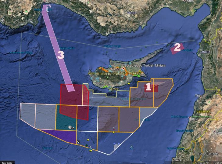
An unprecedented escalation of Turkish provocations is being recorded these days, culminating in an irregular Turkish navtex for naval exercise using fire, south of Cyprus and at a distance of about 15 kilometers (14 nautical miles) from the coast of Ayia Napa parallel to the coastline of Agia Napa - Xylofagou - Cape Greco. This is an area 40 km long and 20 km wide.
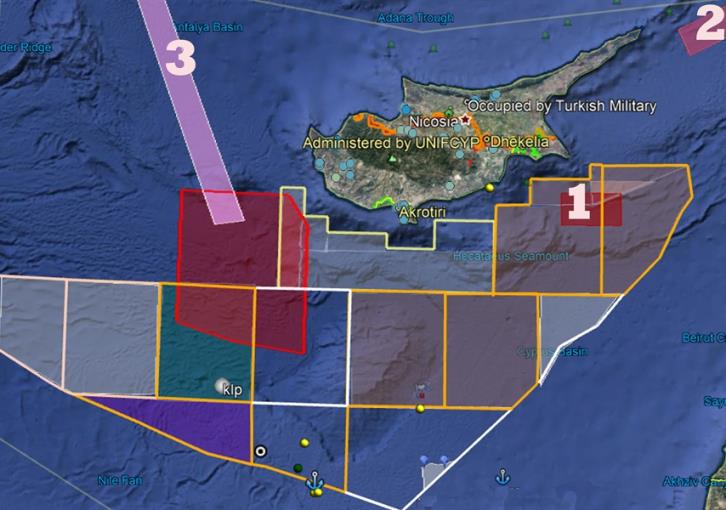
According to the irregular Turkish "commitment", the exercise will take place tomorrow, Wednesday, October 25, from 7.00 to 9.00 in the evening. The area that was "committed" with the Turkish irregular navtex issued by the Navy, Hydrology and Oceanography Office of the Turkish Navy, is marked on the first map with no. 1.
The Search and Rescue Coordination Center of the Republic of Cyprus has issued a statement to seafarers, informing them of the illegality of Turkish actions in the area of responsibility for search and rescue of the Republic of Cyprus. Ships sailing in the area are invited to contact the legally competent services of the Republic.
A second exercise - search and rescue in this case - has been announced for an exercise east of Apostolos Andreas - on map no. 2.
At the same time, with a third irregular navtex, Turkey temporarily modified the request of the two seismographs operating illegally within the Cyprus EEZ, Barbaros and Apollo Moon.
Specifically, from today until the end of the week, "a zone from the west of Paphos to the shores of Mersina was blocked - on the map no. 3.
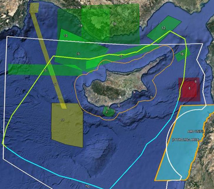
It should be noted that today, according to the Search and Rescue Coordination Center, seven different areas north of Cyprus have been booked for air drills. These are areas in which part or all of them belong to the Nicosia Fir.

Map of the KSED for the Turkish illegal NOTAM that is in force today: 
Source: Liberal
