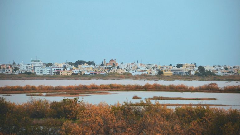
Fears are expressed for a recurrence of the Pissouri phenomenon where a project worth around € 33 million is underway in order to stabilize the subsoil, in which buildings were built for the Lake Paralimni area, in view of the revision of the Local Plan of free Famagusta, but and due to the results of the micro-zonal study that was prepared, the newspaper records in today's report of the journalist Vassos Vassilios "Liberal".
According to information quoted by the newspaper, the area of Lake Paralimni has been designated by the Department of Geological Survey as a danger zone. The danger is not only focused on the composition of the soil but also on the fact that Cyprus is in a seismic area.
According to the same information, the Department considers that due to the unstable soil the area should be characterized as White Belt, so that its development is not allowed, while noting that some parts in the area of the Lake were included in Zone 00A which according to the description by the Department of Geological Survey (for all Zones with the same characteristics) is threatened by geo-hazards and is characterized from instability and increased risk. At the same time, as mentioned, these geo-hazards have negative and destructive effects on the built environment. In this Zone, that is, no new construction or addition to existing development, construction or construction is recommended. The Department of Geological Survey considers that this area should be designated as "Zone 00", ie in White Zone. Of course, the Geological Department cannot impose the inclusion of the area in a White Zone, something that could be done by the Ministry of Interior, through the Department of Urban Planning. It is noted that the Department of Urban Planning has temporarily declared a White Zone part of the Lake within the boundaries of the Municipality of Sotira. This Zone will remain in force until next May, when the Local Plan is expected to be published, in which the Development Zones will be defined.
Lake Paralimni, covers a total area of 107Km2 and is bordered west by the coastal front of Protaras, north by the coastal front of the Municipality of Ayia Napa and a small part of the Municipality of Sotira, south of the ceasefire line as it was formed in 1974 after the Turkish and is located within the municipal boundaries of Paralimni, Sotira and Deryneia.
Regarding the urban planning status of the area, most of it and specifically 93,8% is located in Protection Zone Da1 and a small part in the southern part is protection zone Z1 (2,7%).
In the northern part of the area, next to the exit channel of the lake, a small part of the area is a residential zone Ka8 (3,2%). In the wider area, within the catchment area there is a variety of urban zones.
As mentioned in a text of the Department of Geological Survey, the nuclei of continuous urban construction and other similar residential zones around the area under study prevail and essentially constitute the residential nuclei of Paralimni and Sotira. There are also zones of commercial activities and other central functions, agricultural zones, craft zones, etc.
However, the catchment area of the lake has been included in its largest percentage in residential areas.
As part of the preparation of the micro-zonal study, 17 on-site visits were made and in 12 of them, officials of the Geological Survey Department also participated.
Concerns about the catastrophic past
As reported in the newspaper report "Liberal", one of the data that concerns, are the references to the historical times 76 AD, 300 AD, 332 AD. and 341 AD during which, the ancient city of Salamis (northern part of the city of Famagusta) was leveled by earthquakes. According to the same sources of the Department of Geological Survey, in 1735 AD. Part of the then city of Famagusta was leveled by a strong earthquake which is estimated at 6.6 on the Richter scale. The only reports that have been identified from the state archives concern the earthquake of 1941, with a focus west of the area studied in the context of the micro-zone and was of magnitude 6.2.
Experts point out that until 1994 the buildings were designed without special anti-seismic provisions, while in the period 1994-2012 the Cyprus Anti-Seismic Code was in force, when, from 2012, the Eurocodes came into force.
If the state decides that the wider area of the Lake or parts of it will be included in development zones, Civil Engineers will be able to support the buildings based on the data obtained from the micro-zonal study of free Famagusta.
Lucky in their misfortune from the last earthquake off Paphos, were the residents of the city district of Chrysochous, where as part of the ongoing micro-zonal study, nine accelerometers were installed, who recorded the earthquake's action and behavior. ground, in contrast to the micro-zones in other areas of Cyprus, where, in the absence of an earthquake, some data were estimated approximately instead of being recorded.
The findings are taken for granted to contribute to a safer design of the buildings or to confirm the accuracy of the data taken into account in the current period.
Source: Liberal
