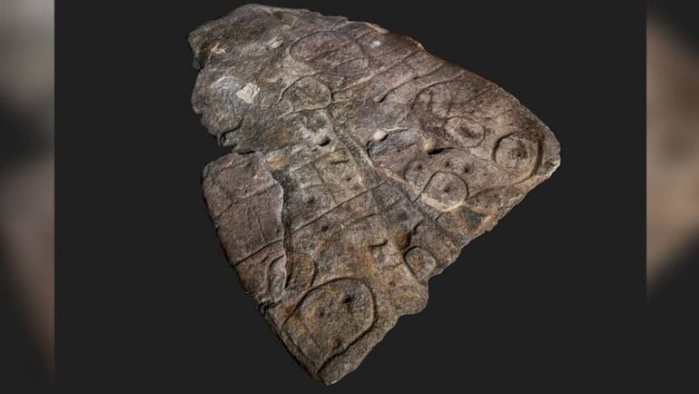
A great discovery was made by researchers, according to whom, a stone slab on which are engraved intricate lines and patterns dating from the Bronze Age, is the oldest map of Europe.
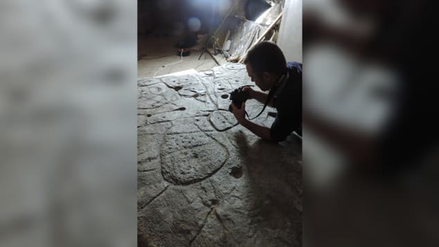
Using high-resolution 1900D research and photogrammetry, researchers re-examined the Saint-Bélec slab - a carved and partially broken piece of stone discovered in XNUMX but forgotten for nearly a century.
Researchers from the French National Institute for Preventive Archaeological Research (Inrap), the University of Bournemouth in the United Kingdom, the French National Center for Scientific Research (CNRS) and the University of Western Brittany say a recent study of the stone revealed soil in Europe.
The plaque, with intricate reliefs and scattered motifs, had an interesting course: it was excavated from a tomb in western Brittany, and experts estimate that it was reused in an ancient burial site towards the end of the Early Bronze Age (between 1900 and 1640) BC), as a wall in a small box containing human remains. At the time of the excavation, the slab, almost four meters long, was already broken and its top was missing.

In 1900, it was transferred to a private museum, and until the 1990s, it was stored in the National Museum of Archeology in Saint-Germain-en-Laye castle, somewhere in the castle moat. In 2014, it was rediscovered in one of the museum cellars.
During the study of the plate, the researchers found that the reliefs looked like a map, with repetitive patterns joined by lines.
They noticed that its surface was deliberately 3D-shaped to represent a valley, with lines in the stone believed to represent a network of rivers.
The team noticed similarities between the engravings and landscape elements of western Brittany, with the ground depicted on the plaque appearing to show an area of about 19 miles along the Odette River.
Clement Nicholas, a postdoctoral researcher at Bournemouth University and lead author of the study, told CNNi that the discovery "marks the cartographic knowledge of prehistoric societies".
However, there are still many unanswered questions, including why the plate broke in the first place.
"The Saint-Bélec plaque depicts the territory of a strong hierarchical political entity that had strictly controlled territory at the beginning of the Bronze Age, and its breaking could indicate condemnation and decentralization," Nicholas said.
The study was published in the French journal Bulletin de la Société préhistorique française.
Source: CNN
