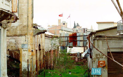
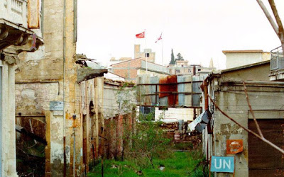
The territorial aspect of the Cyprus issue and the mapping of the territories of each state component on a map is one of the crucial issues that must be resolved in the context of a solution and is the subject of the current phase of talks between President Nikos Anastasiadis and the Turkish Cypriot leader. Mustafa Akinci, continuing this month in Geneva, where the two sides are scheduled to present their maps on January 11th.
A source from the Greek Cypriot side told KYPE that the fact that maps will be submitted on both sides for territorial adjustments at the same time is an important development, adding that what is expected is that the maps will show the criterion of the territory of each state component. on which there was in principle in Mont Peléran an agreement as to the extent of the Turkish Cypriot state component, between 28,2% -29,2%.
He added that the Greek Cypriot side will have map variations in its luggage and that it expects that in Geneva the two sides will continue the discussion on the criteria for the territory before the presentation of their maps, reminding that there was no agreement on the other two criteria. concern the number of refugees who will return under Greek Cypriot administration and the percentage of the coastline of each side.
The same source also said that to a large extent the convergence or divergence that will exist in the maps that will be submitted will affect the climate during the Conference on Security and Guarantees. Asked whether maps and proposals for territorial adjustments that had been made in the past have been taken into account during the preparation of the Greek Cypriot side, the same source said that "of course they are taken into account", adding that "there are some sensitivities".
He added that, for example, for the Greek Cypriot side, what matters is the return of areas that were densely populated before the Turkish invasion.
In the past, both the two sides and the United Nations have prepared maps and made proposals for territorial adjustments, but no agreement has been reached. The "mapping" of the Cyprus problem began early in the context of bi-communal talks after the Turkish invasion of 1974.
In 1977, during the sixth round of talks, the Greek Cypriot side came up with proposals for both the Constitution and the Territorial. In this context, the Greek Cypriot side prepared a map (31/3/1977) which provided a ground percentage of 80,3% for the Greek Cypriot side and 19,7% for the Turkish Cypriot side. The Greek Cypriot side received 75,3% of the coastline and the Turkish Cypriot 24,7%. The number of Greek Cypriots who would return was 109.515. This proposal was reiterated on 8 October 1980.
On April 13, 1978, the Turkish Cypriot side submitted proposals. The dead zone would be placed under Greek Cypriot administration while in the case of the other territories there was only alignment resulting in the return of only 1,2% of the territories. Thus, 64,8% would belong to the Greek Cypriot component state, which would have control of 44,5% of the coastline. 35,2% of the territory would belong to the Turkish Cypriot component state, which would have control of 55,5% of the coastline. A total of 4.124 Greek Cypriots would return.
On August 5, 1981, the Turkish Cypriot side submitted new proposals on a number of issues, including the Territorial. Its map provided for a land percentage of 33,4% for itself and 66,6% under Greek Cypriot administration. The Turkish Cypriot side would have 53,4% of the coastline and the Greek Cypriot side 46,6% while 13.818 Greek Cypriots would return.
The same year followed the first map of the UN Special Representative Hugo Gobi with which 72,6% of the territory was placed under Greek Cypriot administration and 27,4% under Turkish Cypriot administration. Regarding the coastline, 49,8% would belong to the Greek Cypriot side and 50,2% to the Turkish Cypriot side. 78.025 Greek Cypriots would return.
The second Gobi map also from 1981 gave 0,2% more land on the Greek Cypriot side (72,8%) and 27,2% on the Turkish Cypriot side. The percentages of the coastline for each side remained the same while 79.720 Greek Cypriots would return.
In August 1992, the map of the then UN Secretary General Boutros Boutros-Ghali with the territorial adjustments was submitted, which was integrated in the "Bundle of Ideas" Gali for a framework of a comprehensive agreement on the Cyprus issue. The map provided for a percentage of 72,1% under Greek Cypriot administration and 27,9% under Turkish Cypriot administration. According to the map, the Greek Cypriot side would own 49,9% of the coastline and the Turkish Cypriot side 50,1%. 78.912 Greek Cypriots would return.
In December 1999, there were two maps from the Greek Cypriot side in the context of its proposals for the Territorial. In both cases the percentages of land and coastline remained the same, only the number of Greek Cypriots who would return changed. The Greek Cypriot constituent state would have 76% of the territory and the Turkish Cypriot 24%, while the Greek Cypriot side would control 65% of the coastline and the Turkish Cypriot 35%. According to the first map, 107.778 Greek Cypriots would return and according to the second, 99.916.
The next proposals for territorial adjustments were made in the context of the discussions on the various versions of the Annan Plan.
Based on the proposal of the first Plan in November 2002, the Greek Cypriot constituent state would have 71,4% of the territory and the Turkish Cypriot 28,6%. The Greek Cypriot side would have 45,5% of the coastline and the Turkish Cypriot side 54,5%, while 82.170 Greek Cypriots would return.
A second proposal from the United Nations followed in the same month, according to which the Greek Cypriot constituent state would have 71,5% of the territory and the Turkish Cypriot 28,5%. The Greek Cypriot side would have 58,3% of the coastline and the Turkish Cypriot side 41,7%, while 79.947 Greek Cypriots would return.
In December 2002, there was a proposal from the Greek Cypriot side for 73,1% of the territory for the same and 26,9% for the Turkish Cypriot side. The coastline of each side would be 60,3% and 39,7%, respectively. A total of 100.311 Greek Cypriots would return.
The proposal included in the Annan Plan 2 in December 2002 provided for 71,5% of the territory under Greek Cypriot administration and 28,5% under Turkish Cypriot administration, while 59% of the coastline would be under Greek Cypriot administration and 41% under Turkish Cypriot. 79.947 Greek Cypriots would return.
This was followed by the proposals on the Territorial Plan in Annan Plan 3 in February 2003, on March 29, 2004 (Annan Plan 4) and on March 31, 2004 (Annan Plan 5 which was put to a referendum). All three proposals provided for 71,3% of the territory under Greek Cypriot administration and 28,7% under Turkish Cypriot administration and the return of 86.366 Greek Cypriots. Regarding the coastline percentages in the 2003 proposal, they were 49% for the Greek Cypriot side and 51% for the Turkish Cypriot side, and in the next two proposals 45,7% for the Greek Cypriot side and 54,3% for the Turkish Cypriot side.
Source: KYPE

